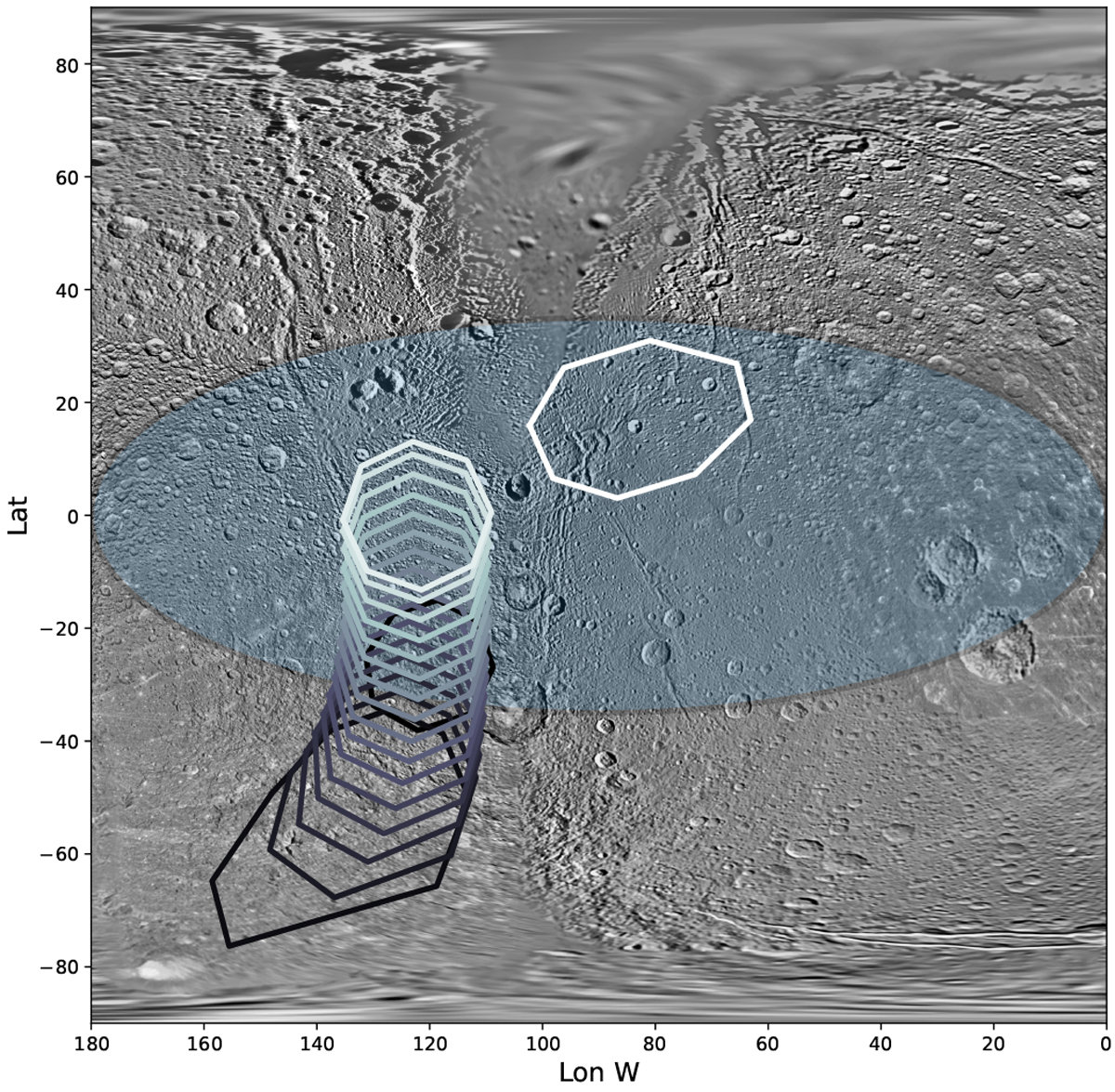
Fig. 6

Download original image
Map of the leading hemisphere of Dione at 154 m resolution provided by the USGS. The lens-shaped region of expected MeV electrons bombardment appears slightly shaded, centered about the equator with a maximum latitudinal extent of 70°. FOV footprints of the CIRS FP1 during observation CIRS_222DI_DIONE001_PIE are plotted in gradually lighter colour from the start to the end of the 3h35 min sequence. One in twenty is printed over 350 footprints.
Current usage metrics show cumulative count of Article Views (full-text article views including HTML views, PDF and ePub downloads, according to the available data) and Abstracts Views on Vision4Press platform.
Data correspond to usage on the plateform after 2015. The current usage metrics is available 48-96 hours after online publication and is updated daily on week days.
Initial download of the metrics may take a while.


