Fig. 2
Download original image
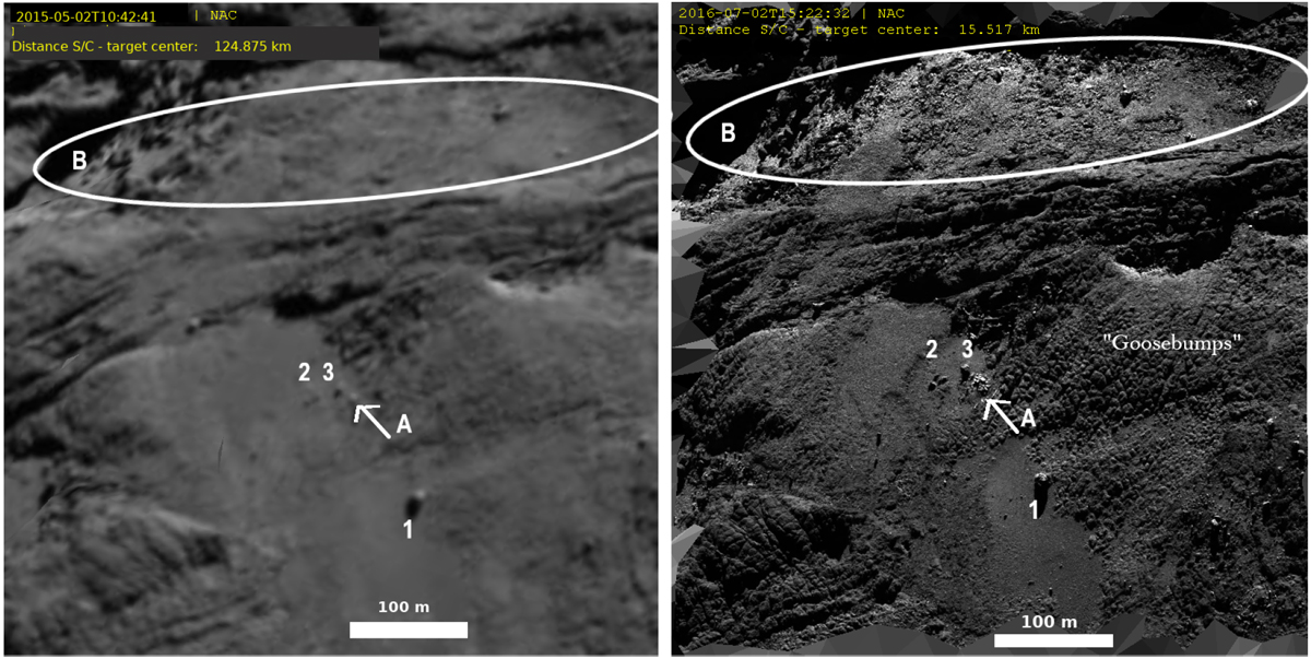
Comparison between images acquired on May 2015 (on the left, spatial resolution (res) of 2.3 m px−1) and on July 2016 (on the right, res = 0.3 m px−1) covering part the Wosret region (area a following Thomas et al. 2018 sub-regions definition). A new cluster of outcrops (named A and indicated by the white arrow) is clearly visible on the July 2016 images. Some boulders are indicated for reference (and numbered 1, 2, and 3). The ellipse named B includes a region where the dust coating may also have been thinned during the perihelion passage, as observed close to the cluster of outcrops named A and to the goosebump features.
Current usage metrics show cumulative count of Article Views (full-text article views including HTML views, PDF and ePub downloads, according to the available data) and Abstracts Views on Vision4Press platform.
Data correspond to usage on the plateform after 2015. The current usage metrics is available 48-96 hours after online publication and is updated daily on week days.
Initial download of the metrics may take a while.