Fig. 4.
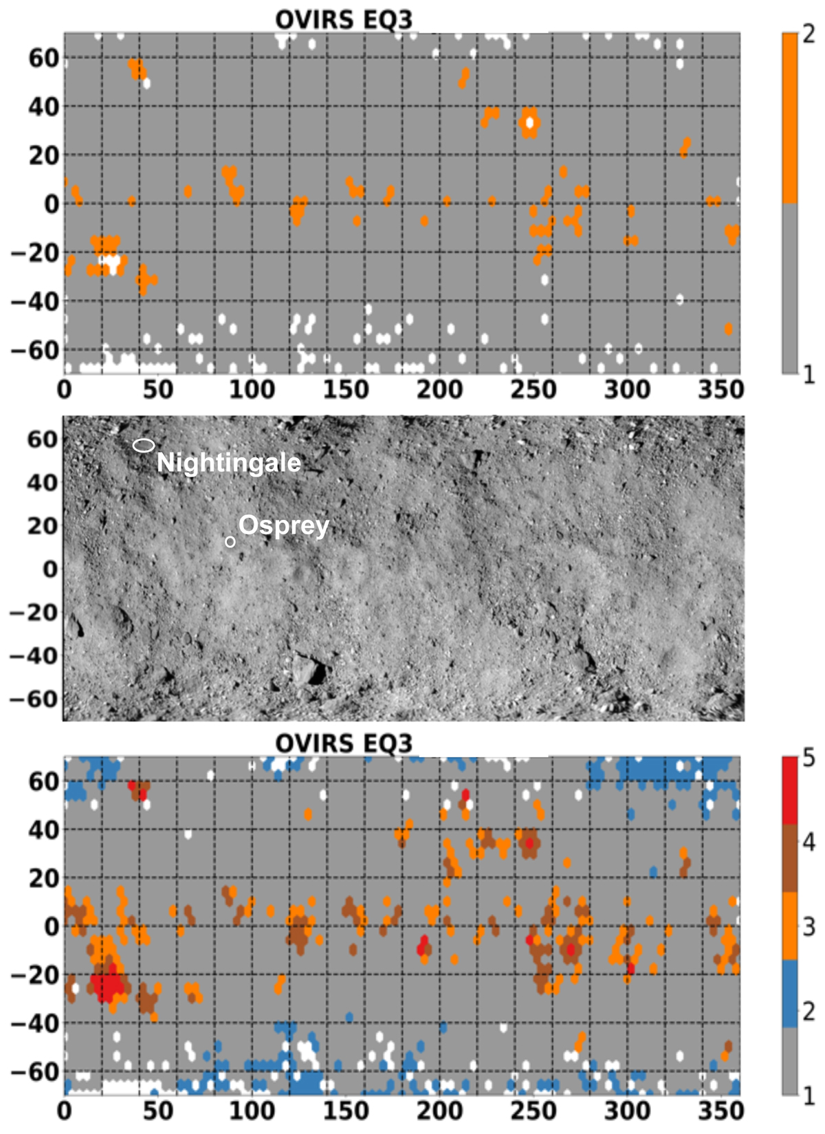
Cylindrical projection maps of Bennu’s surface: geographic distribution of the two groups (grey and orange) obtained at a 2.7σ confidence level (top), map of the surface with craters and features generated from mosaicked V-band images as described by DellaGiustina et al. (2019) (center), and geographic distribution of the five groups obtained at 2.0σ confidence level (bottom). White dots indicate data that are not available or not classified.
Current usage metrics show cumulative count of Article Views (full-text article views including HTML views, PDF and ePub downloads, according to the available data) and Abstracts Views on Vision4Press platform.
Data correspond to usage on the plateform after 2015. The current usage metrics is available 48-96 hours after online publication and is updated daily on week days.
Initial download of the metrics may take a while.