Fig. 9
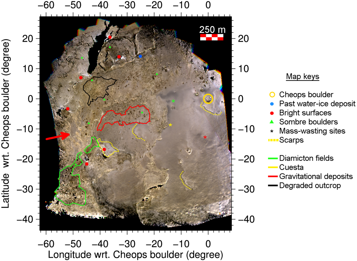
Georeferenced RGB of the April 2016 flyby region, assembled using photometrically corrected NF84, NF82, and NF88 images, and centered around the Cheops boulder. This mapping has a 0.1° × 0.1° resolution in longitude and latitude. The region shown correspond to areas visible in at least three of the considered observations. The locations where resurfacing processes were observed through the evidence of mass-wastings and moving scarps that were discussed in e.g. Groussin et al. (2015) and Deshapriya et al. (2018) are indicated. For clarity, only the largest bright spots are indicated, and the given positions of somber boulders point to their presence in all type of terrains, with the exception of the central depression of Imhotep.
Current usage metrics show cumulative count of Article Views (full-text article views including HTML views, PDF and ePub downloads, according to the available data) and Abstracts Views on Vision4Press platform.
Data correspond to usage on the plateform after 2015. The current usage metrics is available 48-96 hours after online publication and is updated daily on week days.
Initial download of the metrics may take a while.