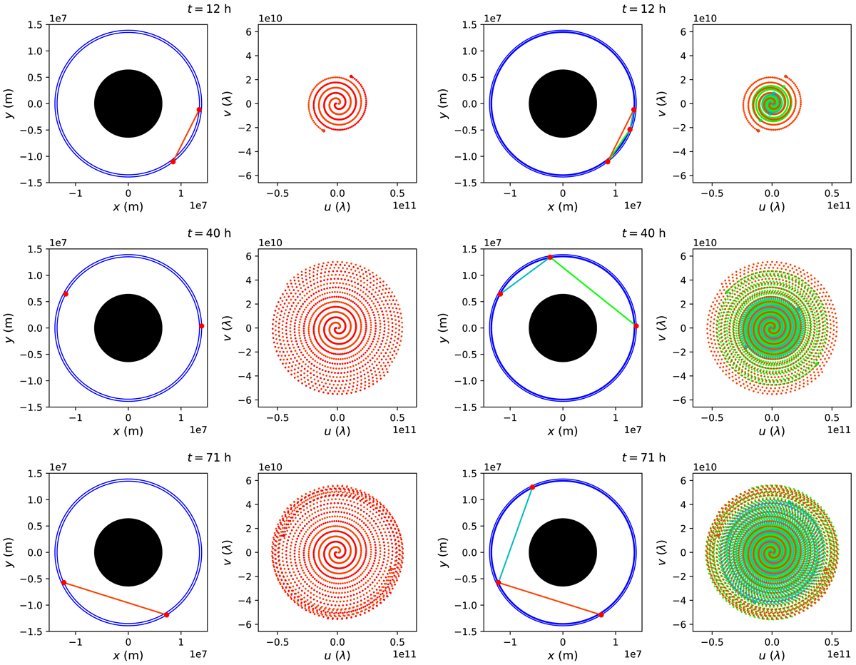
Fig. 1.

Example of satellite positions and uv-coverage for circular MEOs at different time stamps (vertical) for a system consisting of two (Cols. 1 and 2) and three (Cols. 3 and 4) satellites. The orbital radii are 13 500 and 13 913 km for the two-satellite system, and for the three-satellite system a satellite is added at an orbital radius of 13 638 km, at one third of the distance between the two. In order to make the spiral structure visually clearer, the inner radii were set smaller than the ones used in our imaging simulations. In Col. 1, the satellites are shown in red and the corresponding baseline in orange. The orbits are shown in blue, and the Earth is represented by the black disk. In Col. 2, the red and orange points show the past uv-track for the two directions along the baselines. The current uv-coordinates are shown as larger dots. In Cols. 3 and 4, three baselines and uv-tracks are shown in corresponding colors. From the initial satellite positions on the line between them and the Earth’s center, the distance between them increases and the uv-spiral spreads outwards (upper panels) until the Earth atmosphere occults the line of sight between two satellites (middle panels). As the inner satellite catches up with an outer satellite, the spiral is traversed inwards (lower panels).
Current usage metrics show cumulative count of Article Views (full-text article views including HTML views, PDF and ePub downloads, according to the available data) and Abstracts Views on Vision4Press platform.
Data correspond to usage on the plateform after 2015. The current usage metrics is available 48-96 hours after online publication and is updated daily on week days.
Initial download of the metrics may take a while.


