Fig. 4
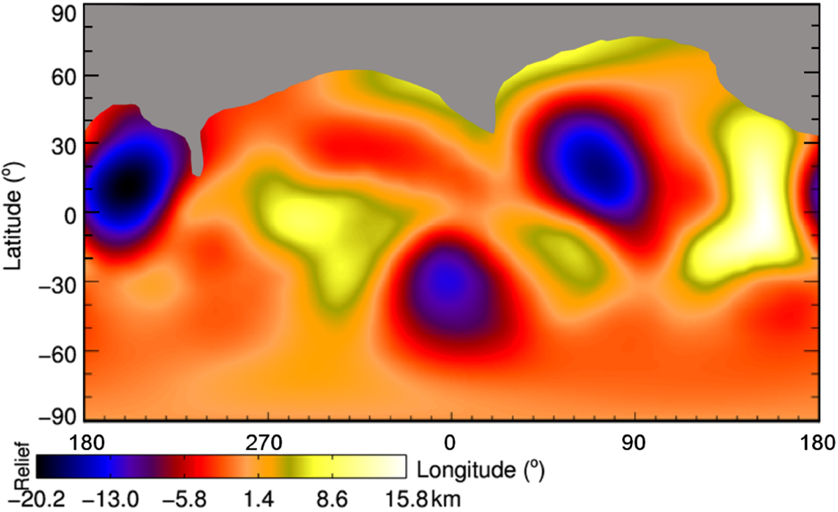
Elevation map (in km) of the shape model of Julia obtained by best-fitting the shape of Julia with an ellipsoid. The gray area (~20% of Julia’s surface) highlights the latitudes that were not covered by our ZIMPOL images. Given the fact that Julia’s shape deviates significantly from ellipsoid, the amplitude of the relief is significantly enhanced with respect to the local topographic relief. Nonetheless, the main surface features are clearly visible (e.g., Nonza at − 32° in latitude). We defined the zero longitude with respect to the center of the Nonza crater.
Current usage metrics show cumulative count of Article Views (full-text article views including HTML views, PDF and ePub downloads, according to the available data) and Abstracts Views on Vision4Press platform.
Data correspond to usage on the plateform after 2015. The current usage metrics is available 48-96 hours after online publication and is updated daily on week days.
Initial download of the metrics may take a while.