Fig. 9.
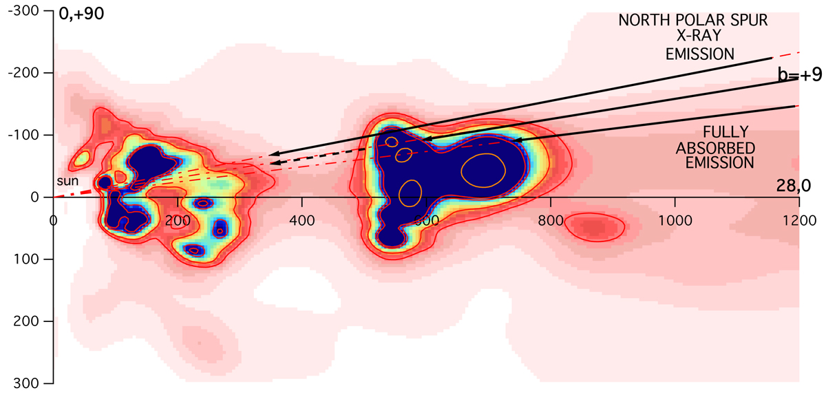
Differential color excess in a vertical plane containing the Sun and along the Galactic longitude l = 28°. The north Galactic pole is at the top. The map shows the distribution of Aquila Rift clouds and more distant structures. The b = +9° dashed line corresponds to the latitude above which X-rays from the North Polar Spur (NPS) start being detected. The very thick cloud absorbing predominantly the NPS at b ≤ +9° is located between 500 and 800 pc.
Current usage metrics show cumulative count of Article Views (full-text article views including HTML views, PDF and ePub downloads, according to the available data) and Abstracts Views on Vision4Press platform.
Data correspond to usage on the plateform after 2015. The current usage metrics is available 48-96 hours after online publication and is updated daily on week days.
Initial download of the metrics may take a while.