Fig. 1
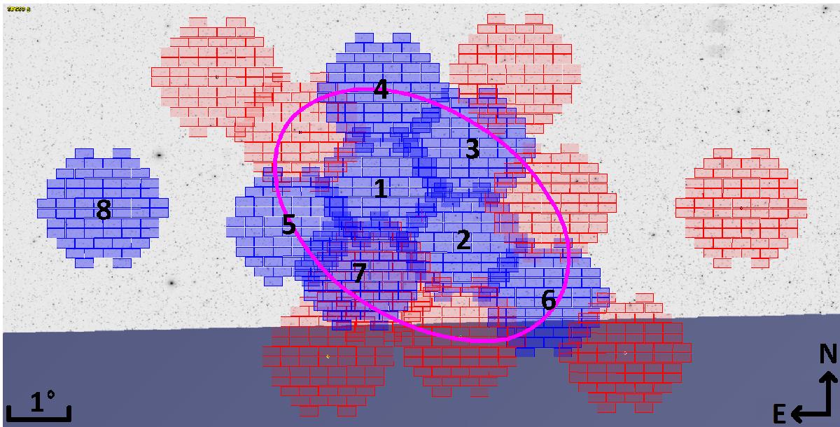
Location of the observed (numbered) and planned (not numbered) DECam pointings around the Sextans dSph, overlaid to SDSS DR9 g band imaging, which covers almost entirely the surveyed area (the blue band is the region lacking SDSS DR9 coverage). Pink ellipse: Contour of the previously estimated King surface density profile of Sextans at its tidal radius. Pointing 7 is from archive DECam observations. The DECam FoV used to prepare this image in Aladin Sky Atlas (Bonnarel et al.2000) was designed by L. Cicuéndez.
Current usage metrics show cumulative count of Article Views (full-text article views including HTML views, PDF and ePub downloads, according to the available data) and Abstracts Views on Vision4Press platform.
Data correspond to usage on the plateform after 2015. The current usage metrics is available 48-96 hours after online publication and is updated daily on week days.
Initial download of the metrics may take a while.