Fig. 5
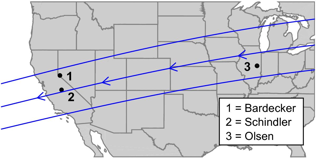
Reconstructed shadow path and geographic locations of all observers across the continental US. The three lines indicate the shadow path’s northern boundary, centerline, and southern boundary, assuming an elliptical shape for 2007 UK126 based on the ellipse fit presented in Fig. 4. The arrows indicate the direction of travel of the shadow on the Earth’s surface from east to west. An animation illustrating the event and the acquired light curves is available online.
Current usage metrics show cumulative count of Article Views (full-text article views including HTML views, PDF and ePub downloads, according to the available data) and Abstracts Views on Vision4Press platform.
Data correspond to usage on the plateform after 2015. The current usage metrics is available 48-96 hours after online publication and is updated daily on week days.
Initial download of the metrics may take a while.