Fig. A.4
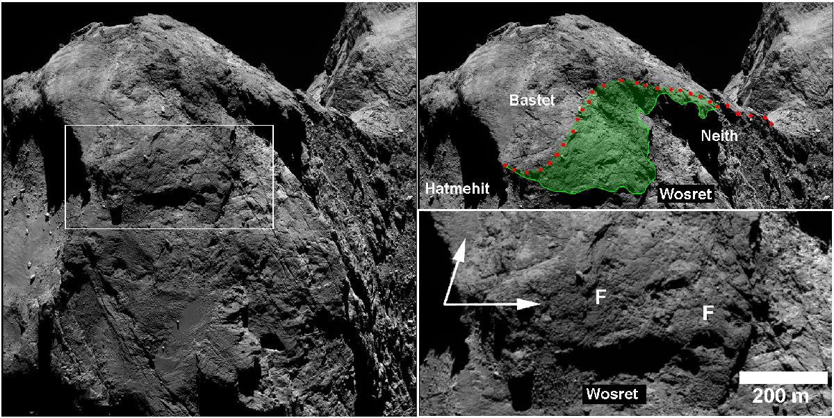
Left and top right: NAC image showing the Bastet region and surrounding terrains as well as a similar view with colored overlays of the regional boundaries. The red dotted line shows the old boundaries of Bastet whereas the green region is the newly-added terrain. The inbox shows the location highlighted in the bottom right panel. Bottom right: a full resolution view of the Bastet-Wosret boundary highlighting the fractured nature of the Bastet boundary (good examples highlighted by the letter “F”). Bastet forms a scarp overlying the Wosret region. Note the difference in tone between the northern portion of Bastet and the southern part (arrows).
Current usage metrics show cumulative count of Article Views (full-text article views including HTML views, PDF and ePub downloads, according to the available data) and Abstracts Views on Vision4Press platform.
Data correspond to usage on the plateform after 2015. The current usage metrics is available 48-96 hours after online publication and is updated daily on week days.
Initial download of the metrics may take a while.