Fig. 5
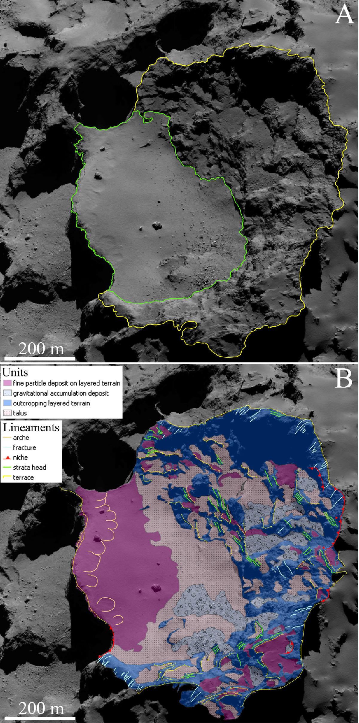
A) Uninterpreted image of the Aswan site. The green area shows the largest terrace of Aswan, i.e., the Philae nominal proposed site A, while the yellow area indicates the surrounding cliff. B) Morphological map of the Aswan site presenting the identified units and lineaments. This map was derived from the NAC image taken on September 22, 2014, at 15.50.04 UT at a distance of 28.39 km from the comet center. The corresponding scale is 50 cm/px.
Current usage metrics show cumulative count of Article Views (full-text article views including HTML views, PDF and ePub downloads, according to the available data) and Abstracts Views on Vision4Press platform.
Data correspond to usage on the plateform after 2015. The current usage metrics is available 48-96 hours after online publication and is updated daily on week days.
Initial download of the metrics may take a while.