Fig. 1
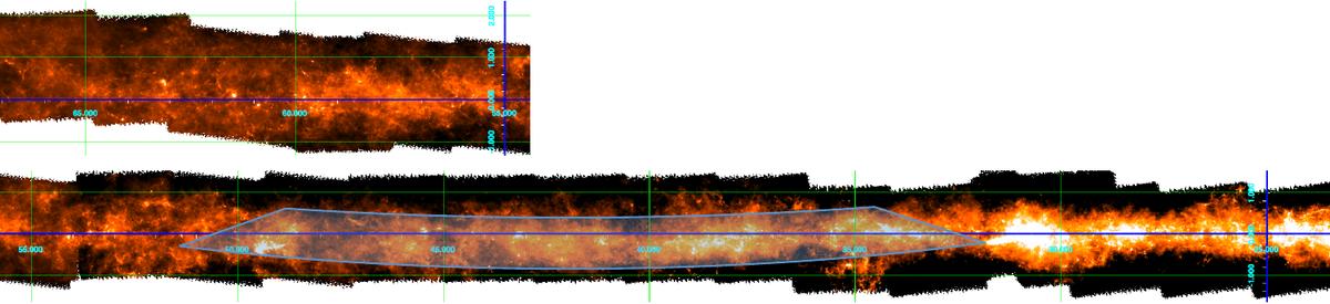
a) 500-μm panoramic mosaic of the Galactic plane for the longitude range 54°≤ l ≤ 67° (upper panel) and 23.̊5 ≤ l ≤ 56° (lower panel). The longitude and latitude scales are given in the figures. The horizontal blue line marks b = 0°, while the green-line grid marks intervals of 5° in longitude and 1° in latitude. The lightly shaded areas are intended to visually emphasise the slow latitude modulations of the overall dust thermal emission.
Current usage metrics show cumulative count of Article Views (full-text article views including HTML views, PDF and ePub downloads, according to the available data) and Abstracts Views on Vision4Press platform.
Data correspond to usage on the plateform after 2015. The current usage metrics is available 48-96 hours after online publication and is updated daily on week days.
Initial download of the metrics may take a while.