Fig. 7
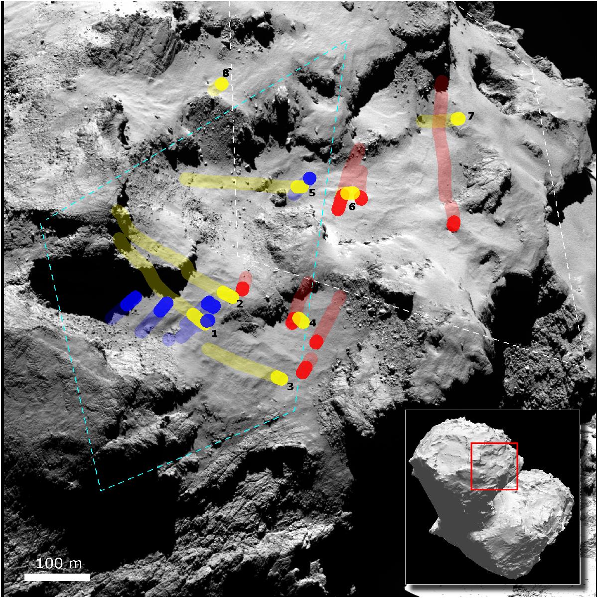
Trails of possible sources of sunset jets superposed on a context image. Trails in red, yellow, and blue, correspond to jets identified in Fig. 2g, h, and i, respectively. The opaque parts of the trails indicate possible sources with reconstructed jets that are inclined by 60 ° to 120 ° relative to the local surface; jets originating from the transparent parts of the trails would be inclined by less than 60 ° or more than 120 ° with respect to the local surface. The background image was taken by OSIRIS NAC at UTC 2014-09-19 23:10:10. The field of view with respect to the nucleus (shape model as in Preusker et al. 2015) is indicated by the red rectangle in the lower right panel. The dashed line in light-blue and white roughly outline the areas in Figs. 11 and 12, respectively.
Current usage metrics show cumulative count of Article Views (full-text article views including HTML views, PDF and ePub downloads, according to the available data) and Abstracts Views on Vision4Press platform.
Data correspond to usage on the plateform after 2015. The current usage metrics is available 48-96 hours after online publication and is updated daily on week days.
Initial download of the metrics may take a while.