Fig. 11
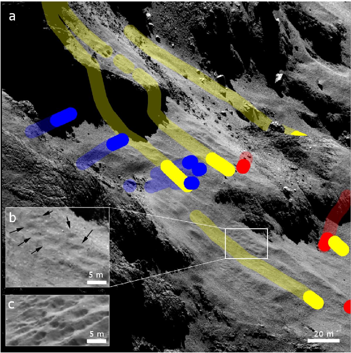
Morphology of the source area of sunset jets. a) NAC image acquired on October 22, 2014, at a distance of ~10 km with an oblique view of the source area at a higher spatial resolution than that of Fig. 7. The image covers an area roughly outlined by dashed light-blue line in Fig. 7, and the trails of possible sources of sunset jets are displayed accordingly. b) Enlarged view of the area highlighted in the white rectangle. The arrows indicate some subdued pitted texture in the dust cover. c) Cropped NAC image acquired on October 19, 2014 at a similar distance, showing the distinct pitted texture elsewhere in the Ma’at region at the same size-scale for comparison.
Current usage metrics show cumulative count of Article Views (full-text article views including HTML views, PDF and ePub downloads, according to the available data) and Abstracts Views on Vision4Press platform.
Data correspond to usage on the plateform after 2015. The current usage metrics is available 48-96 hours after online publication and is updated daily on week days.
Initial download of the metrics may take a while.