Fig. 1
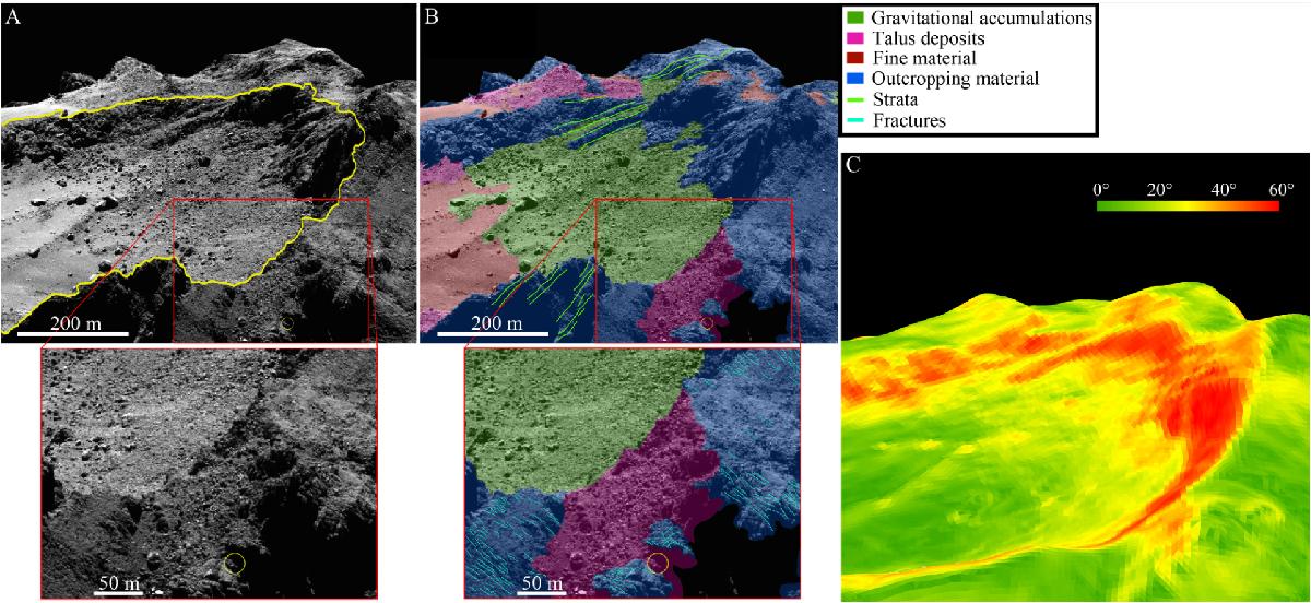
(A) OSIRIS NAC image acquired on 6 December 2014 at 10:52:53 UT at an average phase angle of 90° (top panel) with a close-up of the Abydos site (bottom). The region surrounding the putative landing site of Philae is identified here by a yellow circle, while the Hatmehit depression is outlined in yellow in the top panel. (B) The geomorphological map identifying the main geological units, produced on the image shown in the top panel of Fig. 1A, is displayed in the top panel with the close-up of the Abydos site showing both geomorphological units and linear features (bottom panel). (C) Gravitational slope map of the image obtained using the 3D shape model, derived with the stereo-photoclinometry (SPC) technique, and the gravitational potential model derived assuming a homogeneous nucleus and accounting for the centrifugal force that is due to the nucleus rotation.
Current usage metrics show cumulative count of Article Views (full-text article views including HTML views, PDF and ePub downloads, according to the available data) and Abstracts Views on Vision4Press platform.
Data correspond to usage on the plateform after 2015. The current usage metrics is available 48-96 hours after online publication and is updated daily on week days.
Initial download of the metrics may take a while.