Fig. 1
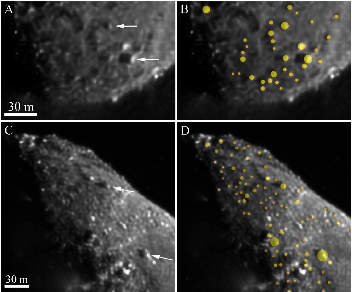
Example of the methodology used to identify the boulders on the surface of 103P. A) Subframe of a HRI-V image (HV10110413-5004015-001) taken on 4 November 2010 at a distance of 1416.4 km from the surface of 103P. The scale of the image is 2.83 m/px. The white arrows indicate the direction of the solar irradiation. In this figure, the shadows of the boulders are observable on the left of such positive reliefs. B) The same image with the detected boulders indicated in yellow circles are presented. C) Subframe of a HRI-V image (HV10110414-5006002-001) taken on 4 November 2010 at a distance of 1407.2 km from the surface of 103P. The scale of the image is 2.81 m/px. The white arrows indicate the direction of the solar irradiation. As from the above image, the shadows of the boulders are observable on the left of the positive reliefs. D) The same image with the detected boulders indicated in yellow circles.
Current usage metrics show cumulative count of Article Views (full-text article views including HTML views, PDF and ePub downloads, according to the available data) and Abstracts Views on Vision4Press platform.
Data correspond to usage on the plateform after 2015. The current usage metrics is available 48-96 hours after online publication and is updated daily on week days.
Initial download of the metrics may take a while.