Fig. 1
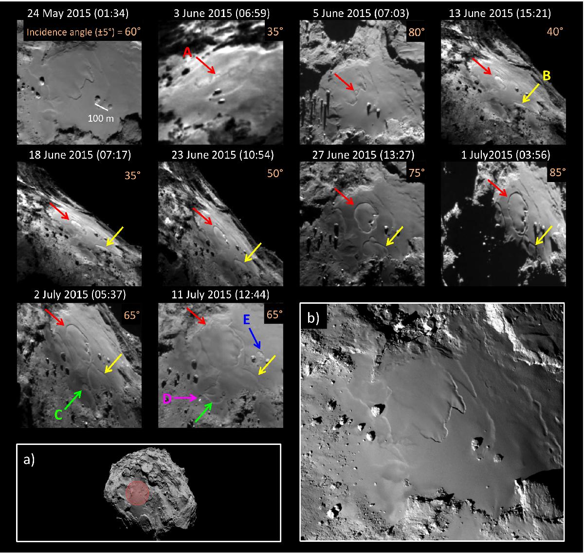
Temporal evolution of the smooth terrains of Imhotep from 24 May 2015 to 11 July 2015 (UT). The arrows indicate the position of the five main detected changes, labeled A to E. The spatial resolution improved from 4.3 m/pix to 3.0 m/pix over the period. The white line on 24 May shows a 100 m reference scale that corresponds to the distance between two remarkable boulders that are visible in all images. Panel a) shows the regional context with the region of changes highlighted in red. Panel b) shows the smooth terrains at high spatial resolution (1 m/pix) in September 2014, before the changes (adapted from Auger et al. 2015). All the images were acquired with the Narrow Angle Camera (NAC) of the OSIRIS instrument.
Current usage metrics show cumulative count of Article Views (full-text article views including HTML views, PDF and ePub downloads, according to the available data) and Abstracts Views on Vision4Press platform.
Data correspond to usage on the plateform after 2015. The current usage metrics is available 48-96 hours after online publication and is updated daily on week days.
Initial download of the metrics may take a while.