Fig. 8
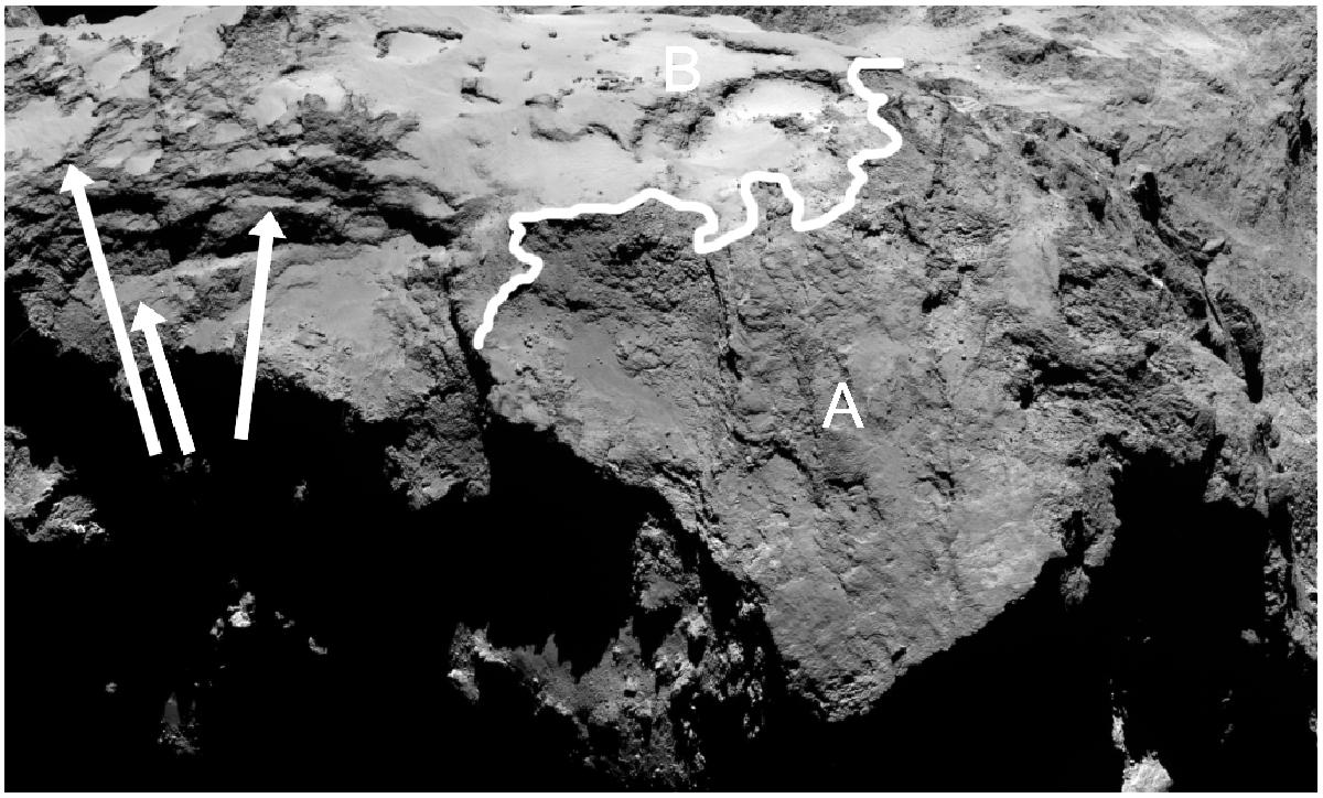
View of the boundary of Apis and Ash. Ash (the area near B) shows smooth terrain with outcrops and exposures of more consolidated material beneath. Apis (area around A) appears rougher with less evidence of any airfall deposit. The region to the left of the figure appears layered. The arrows point to north-facing terraces and slopes that show evidence of the smooth material. Slopes nearly orthogonal to these surfaces are rough and show little evidence of the smooth deposit. The line defines part of the boundary between the smooth surfaces of Ash and the rougher terrains of Apis. Image: NAC_2014-09-03T01.44.22.585Z_ID10_1397549900_F22.
Current usage metrics show cumulative count of Article Views (full-text article views including HTML views, PDF and ePub downloads, according to the available data) and Abstracts Views on Vision4Press platform.
Data correspond to usage on the plateform after 2015. The current usage metrics is available 48-96 hours after online publication and is updated daily on week days.
Initial download of the metrics may take a while.