Fig. 3
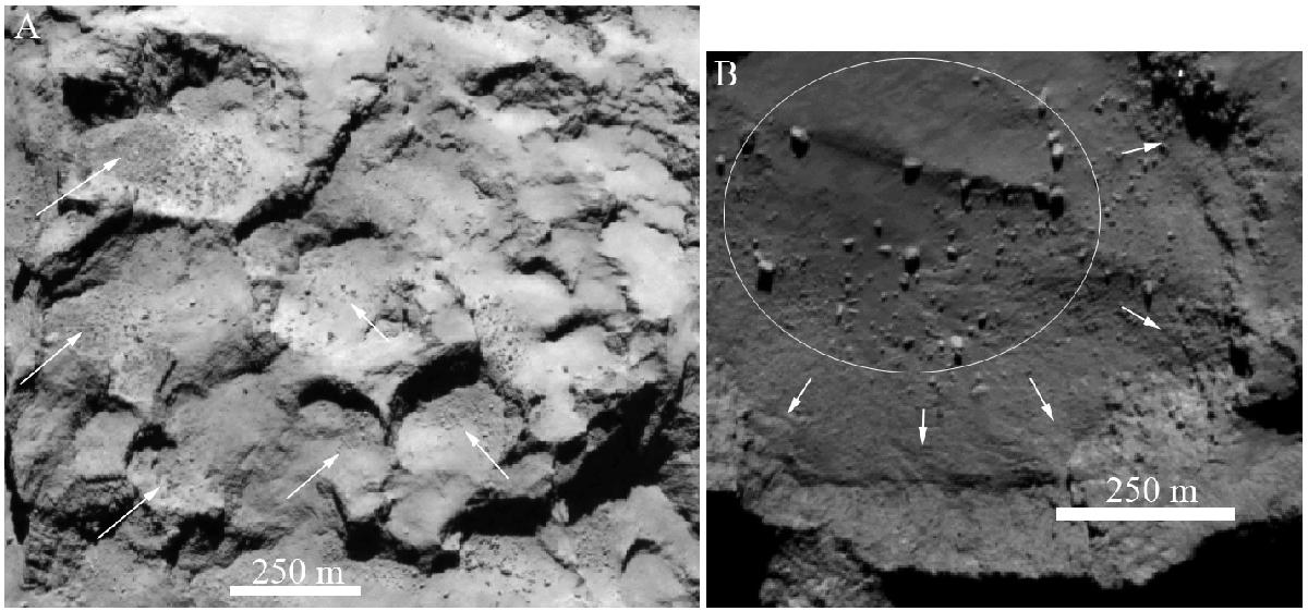
A) Subframe of a NAC image (see Table 6 for image ID) taken on 6 August 2014. Pits in the Seth region are indicated with white arrows together with the corresponding gravitational falls. B) Subframe of a NAC image taken on 6 August 2014 showing a subsection of the Hatmehit depression. At its center, the boulders representative of the remnant part of the past surface area are indicated with the white circle. At the margin of this depression (white arrows) there are deposits related to gravitational phenomena and differential regressive erosion by sublimation.
Current usage metrics show cumulative count of Article Views (full-text article views including HTML views, PDF and ePub downloads, according to the available data) and Abstracts Views on Vision4Press platform.
Data correspond to usage on the plateform after 2015. The current usage metrics is available 48-96 hours after online publication and is updated daily on week days.
Initial download of the metrics may take a while.