Fig. 9
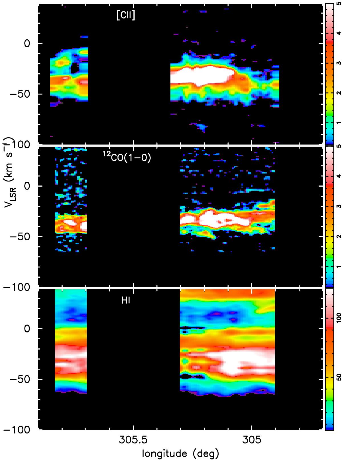
Longitude-velocity (l-V) map covering part of the Crux tangency between longitudes ![]() to 305.̊9. a) HIFI [C ii] maps covered in two OTF longitude scans centered at l = 305.1° and 305.76° at b = 0.̊0 and 0.̊15, respectively. b) The corresponding 12CO map from the Mopra ThrUMMS survey. c) The corresponding H i map from SGPS survey. This map region is off to the right of the l-V trajectory of the Crux tangency, as shown in Fig. 1 (see text). See also the caption of Fig. 3 for details on the display.
to 305.̊9. a) HIFI [C ii] maps covered in two OTF longitude scans centered at l = 305.1° and 305.76° at b = 0.̊0 and 0.̊15, respectively. b) The corresponding 12CO map from the Mopra ThrUMMS survey. c) The corresponding H i map from SGPS survey. This map region is off to the right of the l-V trajectory of the Crux tangency, as shown in Fig. 1 (see text). See also the caption of Fig. 3 for details on the display.
Current usage metrics show cumulative count of Article Views (full-text article views including HTML views, PDF and ePub downloads, according to the available data) and Abstracts Views on Vision4Press platform.
Data correspond to usage on the plateform after 2015. The current usage metrics is available 48-96 hours after online publication and is updated daily on week days.
Initial download of the metrics may take a while.