Fig. A.1
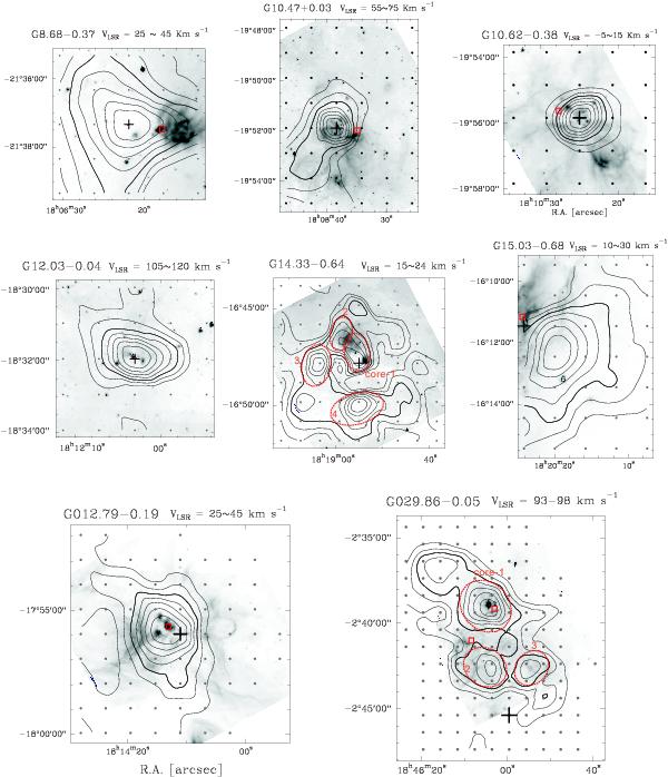
13CO (1 − 0) maps (contours) overlaid on the far-infrared images (gray). The thick contour in each map denote the 50 per cent level of the maximum intensity. For each map, the interpolation is performed upon a grid with 100 × 100 pixels. For all the regions, it is guaranteed that the pixel size is far smaller than the mapping step. And in each panel, the black cross indicates the central position (where the maser locates), the square indicates the radio continuum source (plausible Ultra- or Hyper-Compact Hii regions, if they exist), the dashed ellipses indicate the identified cores if there are overlapped multiple cores.
Current usage metrics show cumulative count of Article Views (full-text article views including HTML views, PDF and ePub downloads, according to the available data) and Abstracts Views on Vision4Press platform.
Data correspond to usage on the plateform after 2015. The current usage metrics is available 48-96 hours after online publication and is updated daily on week days.
Initial download of the metrics may take a while.