Fig. 3
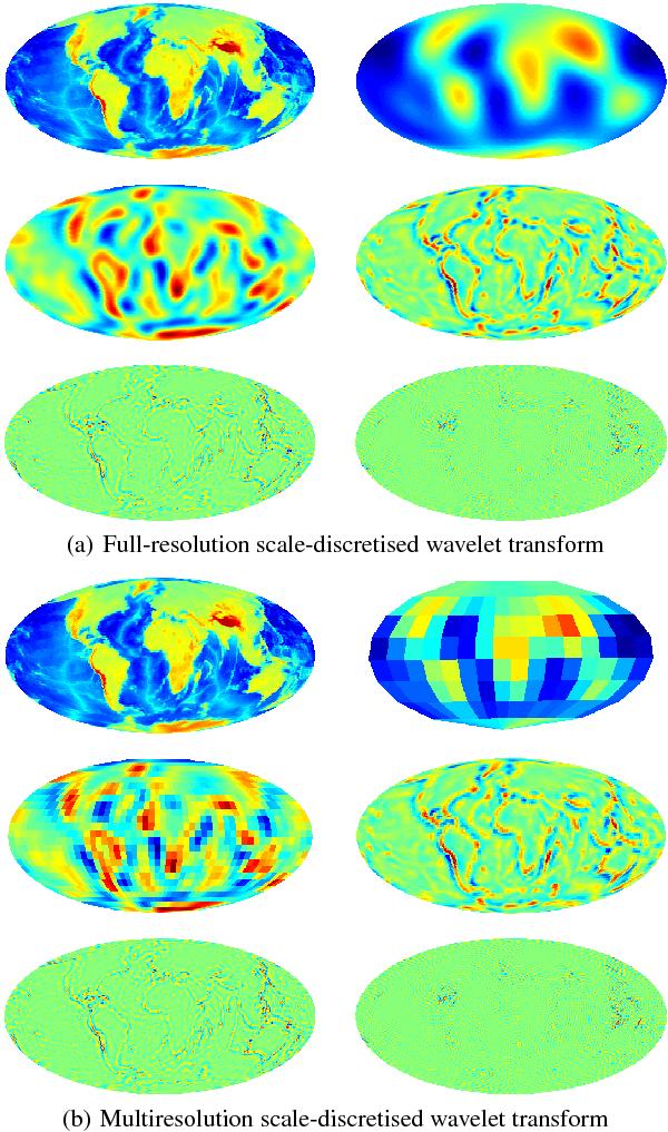
Scale-discretised wavelet transform of a band-limited topography map of the Earth for λ = 3, J0 = 2 and L = 128, i.e. with the scale-discretised wavelets shown in Fig. 2. The wavelet transform decomposes the band-limited signal into wavelet coefficients that extract spatially localised, scale-dependent features. Since the wavelets for different scales j have different band-limits, the wavelet coefficients can be reconstructed at lower resolution on the sphere for lower scales j. Panel a) shows the full-resolution wavelet transform of the topography map. The original Earth topography map is shown in the top-left plot, the scaling coefficients are shown in the top-right plot, while the wavelet coefficients at scales j ∈ { 2,3,4,5 } are shown left-to-right, top-to-bottom respectively in the remaining plots. Panel b) shows the same decomposition but using the multiresolution algorithm. The signals shown in panel b) contain the same information as in panel a) but represented in the minimal number of samples on the sphere. These plots were produced by one of the many Matlab demos provided with S2LET.
Current usage metrics show cumulative count of Article Views (full-text article views including HTML views, PDF and ePub downloads, according to the available data) and Abstracts Views on Vision4Press platform.
Data correspond to usage on the plateform after 2015. The current usage metrics is available 48-96 hours after online publication and is updated daily on week days.
Initial download of the metrics may take a while.