Fig. 7
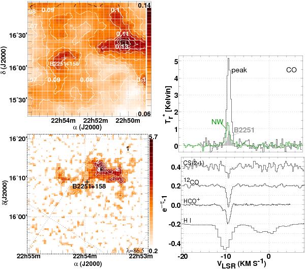
The sky field around the position of B2251+158 (C454.3), as in Fig. 2. The map of reddening at upper left is offset to show a separate peak to the Northwest near 22H50M and a profile at the position of this peak is shown at upper right, shaded green and labeled “NW”, along with profiles toward 3C 454.3 (shaded) and at the peak of the small clump that is seen immediately adjacent to the continuum source.
Current usage metrics show cumulative count of Article Views (full-text article views including HTML views, PDF and ePub downloads, according to the available data) and Abstracts Views on Vision4Press platform.
Data correspond to usage on the plateform after 2015. The current usage metrics is available 48-96 hours after online publication and is updated daily on week days.
Initial download of the metrics may take a while.