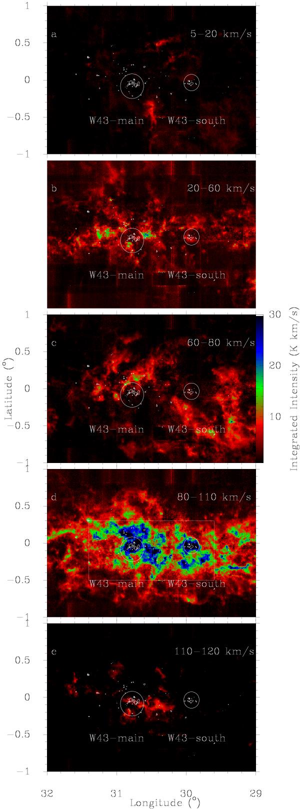
Fig. 3

Integrated maps of the 13CO 1–0 line (in color scale) in the direction of the W43 molecular cloud complex whose densest parts are outlined by the 870 μm continuum emissions (in contours). The various velocity intervals used for the integration correspond to : a)–b) clouds not associated with W43; c), e) clouds emitting in the low- and high-velocity wings of the W43 line shown in Fig. 2; d) the main velocity range of the W43 molecular complex. The white circles indicate W43-main and W43-south, their areas are used to integrate the spectra of Fig. 2.
Current usage metrics show cumulative count of Article Views (full-text article views including HTML views, PDF and ePub downloads, according to the available data) and Abstracts Views on Vision4Press platform.
Data correspond to usage on the plateform after 2015. The current usage metrics is available 48-96 hours after online publication and is updated daily on week days.
Initial download of the metrics may take a while.


