Fig. 1
Download original image
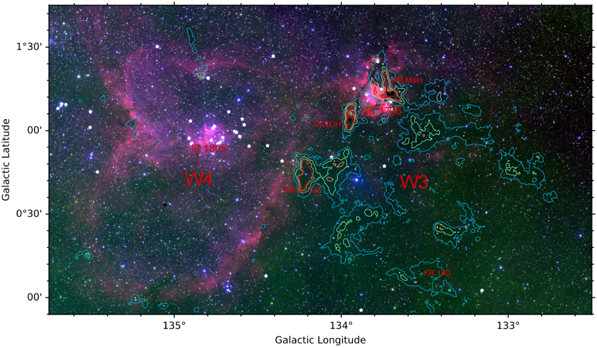
Optical Digitized Sky Survey (DSS) red–green–blue (RGB) image (Red: DSS2 Red (F+R); Blue: DSS2 Blue (XJ+S); Green: DSS2 NIR (XI+IS).) of the W3/4 region. Color contours are velocity-integrated intensity of 13CO (1−0) emission in the integrated Local Standard of Rest velocity range from −63 to −28 km s−1, starting at 10 K km s−1 (3σ with light blue) on a main beam brightness temperature scale and go up in steps of 15 K km s−1 (more and more red). White stars and black plus signs indicate identified OB stars (Roman-Lopes et al. 2019) and high-mass young stellar object (HMYSOs) (Lumsden et al. 2013), respectively. Since the W3/4 complex is located near the northern tip of the galactic plane within the equatorial coordinate system, galactic longitude and latitude are approximately parallel to right ascension and declination, so that the terms north, south, east and west are almost synonymous in both coordinate systems and are applied below sometimes without explicitly mentioning the reference system.
Current usage metrics show cumulative count of Article Views (full-text article views including HTML views, PDF and ePub downloads, according to the available data) and Abstracts Views on Vision4Press platform.
Data correspond to usage on the plateform after 2015. The current usage metrics is available 48-96 hours after online publication and is updated daily on week days.
Initial download of the metrics may take a while.